-
 Information
Route Schweiz-Mobil Route 380: Kehrsatz-Thurnen (Wanderland) Distance 18 km Hiking time 5 h 15 min Grade easy (hiking trail) Fitness level medium Ascents 720 m Descents 740 m Accessibility not barrier-free -
 How to get there
Public transport
We recommend taking public transport. Starting point is at Kehrsatz station, the end of the hike is at Thurnen station.
Car
Public parking is available at Kehrsatz and Thurnen train stations. The number of spaces is limited, which is why we recommend travelling by public transport.
-
Fact
The hiking trail is marked on the yellow signposts by a green logo with the words “Gürbentaler Höhenweg” and the respective route number – number 380 in this case. Nonetheless, we recommend bringing a printout of the route just to be sure.
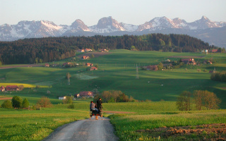
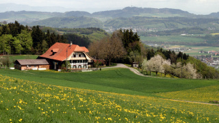
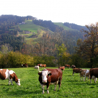
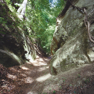
The Gürbentaler Höhenwanderweg in the Gantrisch Nature Park begins in Kehrsatz and takes you up through the forest to Kühlewil. At the top, a beautiful view awaits – in clear weather, you can see all the way to the snowy peaks of the Alps. The hike continues through tranquil forests and past lush fields along Längenberg hill, from where you can see Bern’s local mountain, the Gurten. There are also plenty of other attractions on the Gürbetaler Höhenweg: At the edge of the Cholholz forest, you’ll come across the “Teufelsburde” (“devil’s rock”), a large erratic boulder which was transported there by the Aare glacier in the last Stone Age. Before people knew how the stone got there, they blamed the devil – hence the name. And you can explore the Pfaffenloch, a cave surrounded by mighty sandstone rock faces. Then you’re on the last stretch through the Mülibach ravine to the village of Mühlethurnen, where the Mülibach stream flows into the river Gürbe.
-
SchweizMobil: Hiking in Switzerland
You might also like
-
 Aktivitäten > Adventure & Sport, Activities > bikingSwiss Bike Park OberriedMore
 -
 Aktivitäten > Wandern, Aktivitäten > Adventure & SportHike from Lüderenalp to MooseggMore
 -
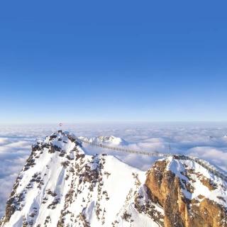 Activitäten > Ausflüge, Aktivitäten > Wandern, Aktivitäten > WinteraktivitätenGlacier 3000More
 -
 Aktivitäten > Wandern, Aktivitäten > Adventure & SportHuttwil HikeMore