-
 Information
Route SchweizMobil Route 4 ViaJacobi, stage 12 (Wanderland) Distance 21 km Hiking time Schwarzenburg–Wattenwil 5 h 50 min Grade easy (hiking trail) Fitness level hard Ascents 720 m Descents 520 m Accessibility not barrier-free -
 How to get there
Public transport
We recommend taking public transport. The departure point in Schwarzenburg is right by the train station. If you want to start in Wattenwil, you can take bus line 51 from Thun station to “Wattenwil, Bären”.
Car
Public parking is available in the Märitplatz parking near Schwarzenburg train station. It is about a five-minute walk from the parking lot to the starting point. There are also public parking spaces near Wattenburg, Bären. However, the number of spaces is limited, which is why we recommend travelling by public transport.
-
Tipp
The hiking trail is marked on the yellow signposts by a green logo with the words “ViaJacobi” and the respective route number – number 4 in this case. Nonetheless, we recommend bringing a printout of the route just to be sure.
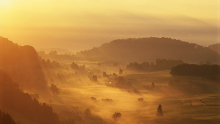
The Wattenwil-Schwarzenburg Hike is the 12th stage of the ViaJacobi on a section of the international Way of St. James. The ViaJacobi stretches from Lake Constance to Geneva over 645 kilometres with 33 stages.
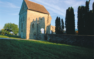
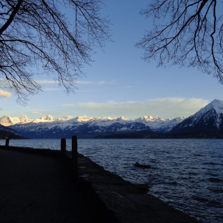
On this scenic hiking route, you’ll discover the ruins of the former monastery of Rüeggisberg, which was built shortly after 1075. When the monastery was no longer occupied, it fell into disrepair. After a village fire, the people of Rüeggisberg used the building blocks to rebuild their houses and the village church. Today, only a fraction of the building is still around. Beautiful views of the Stockhorn mountain range can be enjoyed almost throughout the entire hike, which takes you across open landscapes, past large fields and scattered hamlets.
-
Wanderland SchweizMobil
You might also like
-
 Aktivitäten > Adventure & SportHelikopterflug.chMore
 -
 Aktivitäten > Adventure & Sport, Meetings & Kongresse > Darum Bern, Meetings & Kongresse > Darum BernBSC Young BoysMore
 -
 Activitäten > Ausflüge, Aktivitäten > Wandern, Aktivitäten > WinteraktivitätenGlacier 3000More
 -
 Aktivitäten > WandernGuided Night HikesMore