-
 Information
Route SchweizMobil Route 2: Trans Swiss Trail, stage 14 (Wanderland) Distance 13 km Hiking time 4 h 20 min Grade easy (hiking trail) Fitness level medium Ascents 800 m Descents 600 m Accessibility not barrier-free -
 How to get there
Public transport
We recommend taking public transport. To get to Eggiwil, you can take bus line B 271 from Signau station in the direction of Röthenbach im Emmental and get off at “Eggiwil, Dorf”. To start in Schangnau, you can take bus line B 251 from Escholzmatt station in the direction of Kemmeriboden and get off at “Schangnau, Post”.
Car
There is no public parking in Eggiwil. There is public parking in Schangnau, but the number of spaces is limited, which is why we recommend travelling by public transport.
-
Tipp
The hiking trail is marked on the yellow signposts by a green logo with the words “Trans Swiss Trail” and the respective route number – number 2 in this case. Nonetheless, we recommend bringing a printout of the route just to be sure.

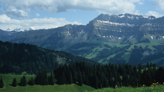
The hike begins in the centre of the town of Eggiwil. Follow the main road for a few minutes until you reach the river Emme, and cross it over a small wooden bridge. On the other side, you’ll find a narrow path which will take you along the burbling Giessbach stream into the forest, and then up across fields all the way to Wachthubel.
Once you reach the top, take the time to take a break, spread your picnic blanket, and enjoy the view of Schrattenflue and Hohgant mountains. If you don’t want to bring your own picnic or you’re feeling peckish, you can stop at one of the inns along the way and order the legendary “Merängge mit Nidle” (meringue with whipped cream) – the Emmental is famous for them! On the other side of Wachthubel, the descent takes you over green fields and back to Schangnau.
-
SchweizMobil: Hiking in Switzerland
You might also like
-
 Aktivitäten > Adventure & SportRafting along the AareMore
 -
 Aktivitäten > Wandern, Aktivitäten > Adventure & SportHiking Tour Wattenwil-SchwarzenburgMore
 -
 Aktivitäten > Wandern, Aktivitäten > Adventure & SportFlüeweg Burgdorf HikeMore
 -
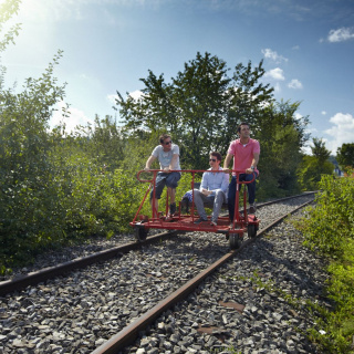 Aktivitäten > Adventure & Sport, Families & Kids, Bern in the fall > Excursions in good weatherRail Bike Ride in LaupenMore